PORSEC 2025
16th Pan Ocean Remote Sensing Conference
Ocean Remote Sensing for Achieving Sustainable Development under Changing Climate
22nd Apr 2025 – 26th Apr 2025 / Keelung, Taiwan
To be continue in Hiroshima, Japan...
About The Event
The 16th Pan Ocean Remote Sensing Conference (2025) is set to convene ocean geospatial experts from Taiwan and across the globe to explore various facets of ocean and atmosphere research utilizing geospatial technology. The purpose of this biennial conference is to provide a cooperative forum where scholars, students, and business executives can present their research and inventions, explore the latest developments, and have conversations aimed at advancing the field. It serves as an interdisciplinary forum where participants can present the latest developments, discuss applications, and promote international partnerships. An engaging social program will be proposed during the conference to encourage networking and interaction among participants. The 10th PORSEC Capacity Building Tutorial will take place in conjunction with the PORSEC 2025 conference, before of the conference. The session provides young scientists and students with expert instruction. Theoretical instruction and hands-on training in remote sensing methods for monitoring the ocean-atmosphere system for operations and research will be provided to participants. Additionally, we would like to extend an invitation to you to submit complete academic papers or abstracts to the conference that touch on any of the following themes—which are not exhaustive—that will be covered at the meeting:
- Large and meso-scale oceanography
- Coastal impacts and management
- Emerging technologies for ocean and coastal applications
- Operational remote sensing
- Ocean-atmosphere interactions
- Remote sensing data for policy making
- Education and outreach
- Artificial intelligence and deep learning
- Fishery resources under climate impact
- Extreme events under climate change
- Application in blue carbon science
We are looking forward to meet all of you in the upcoming conference.
Message from the hostCONFERENCE DAY
22nd - 26th APR 2025
VENUE
National Taiwan Ocean University, Keelung, Taiwan
Timetable
| Time | Day 1 (Tue) 4/22 |
Day 2 (Wed) 4/23 |
Time | Day 3 (Thu) 4/24 |
Time | Day 4 (Fri) 4/25 |
Day 5 (Sat) 4/26 |
||||||
|---|---|---|---|---|---|---|---|---|---|---|---|---|---|
| 08:00-09:00 | Registration (Exhibition Hall) |
08:00-09:00 | Registration (Exhibition Hall) |
08:00-09:00 | Registration (Exhibition Hall) |
Yilan fishing village tour (need additional fee) |
|||||||
| 09:00-09:40 | Opening Ceremony (The First Auditorium) |
09:00-09:40 | Keynote Speak4 Prof. Sei-Ichi Saitoh Introducer: Prof. Chen-Te Tseng (The Second Auditorium) |
09:00-09:40 | Keynote Speak6 Prof. Young-Je Park Introducer: Prof. Ming-An Lee (The Second Auditorium) |
||||||||
| 09:40-10:20 | Keynote Speak1 Prof. Naoto Ebuchi Introducer: Prof. Tai-Wen Hsu (The First Auditorium) |
09:40-10:20 | Keynote Speak5 Prof. DanLing Tang Introducer: Dr. Gad Levy (The Second Auditorium) |
09:40-10:00 | Tea Break (Exhibition Hall) | ||||||||
| 10:20-10:40 | Tea Break (Exhibition Hall) | 10:20-10:40 | Tea Break (Exhibition Hall) | 10:00-11:00 | M1/M3 (The Fourth Auditorium) |
C1 (The Second Auditorium) |
PORSEC scientific member Regular meeting | ||||||
| 10:40-11:20 | Keynote Speak2 Prof. Jong-Shinn Wu Introducer: Prof. Ming-An Lee (The First Auditorium) |
10:40-11:20 | M2 (Distance Learning Classroom 201) |
P1/F1 (Conference Hall of Pi) |
L1/T1/T2 (The Second Auditorium) |
11:00-11:40 | - | ||||||
| 11:20-12:00 | Keynote Speak3 Prof. Wing-Huen Ip Introducer: Prof. Chung-Ru Ho (The First Auditorium) |
11:20-12:20 | 11:40-12:00 | PORSEC Plenary Meeting & Close (The Second Auditorium) |
|||||||||
| 12:00-13:20 | Lunch (Exhibition Hall) | 12:20-13:20 | Lunch (Exhibition Hall) | 12:00-13:20 | Lunch (Exhibition Hall) | ||||||||
| 13:20-15:00 | Registration | C1-1 (Conference Hall of Pi) |
TASA (The Second Auditorium) |
- | 13:20-15:00 | O1 (Distance Learning Classroom 201) | F1 (Conference Hall of Pi) | Pacific Saury Workshop (Mandarin) | 13:20-15:00 | Fisheries Research and Marine Science Technology Workshop | |||
| 15:00-15:20 | Tea Break | 15:20-15:50 | Poster session (Ocean and Mountain View Corridor) | Tea Break (Exhibition Hall) |
15:20-15:50 | ||||||||
| 15:20-17:20 | E1 (Conference hall of Pi) |
A1 (The Second Auditorium) |
COSPAR capacity building session (The Third Auditorium) |
15:50-17:20 | - | Pacific Saury Workshop (Mandarin) | 15:50-17:50 | ||||||
| 18:00-20:30 | - | Welcome Dinner (Keelung Gang Seafood Restaurant) |
18:30-21:00 | - | 18:30-21:00 | Poster & Oral Awarding Ceremony / Farewell party (Aloha Seafood View) |
|||||||
Your Guide to PORSEC 2025
Proceeding and Abstracts Agenda Shuttle Bus and Parking information Photo of us<3 PICES 2025 in Yokohama, JapanImportant Dates
| 1st Oct | Registration Start |
| Before 31st Dec | Deadline: Early bird registration |
| 1st Jan, 2025 – 28th Feb, 2025 | Full Registration Start |
| 28th Feb, 2025 | Deadline: Abstract submission and registration |
| 15th Mar, 2025 | Notification of Acceptance |
TUTORIALS
See TutorialKeynote Speakers
Here are our keynote speakers

Jong-Shinn Wu
- Director General, Taiwan Space Agency
- President, Taiwan Space Industry Development Association (TSIDA)
Optical and Microwave Remote Sensing Development at Taiwan Space Agency

Naoto Ebuchi
- Professor, Institute of Low Temperature Science, Hokkaido University
History and Present Status of JAXA’s Spaceborne Microwave Radiometers, AMSR Series, with Oceanic Applications

Sei-Ichi Saitoh
- Research Professor, Arctic Research Center, Hokkaido University
Space × Aquaculture: A New Approach to Select Optimum Aquaculture Site Using SAR Satellite Data

Wing-Huen Ip
- Chair of Taiwan Space Union
- Professor, Graduate Institute of Astronomy, National Central University
On the needs for space remote-sensing monitoring of the coastal and marine ecosystems

Danling Tang
- Professor, PI
- Southern Marine Science and Engineering Guangdong Laboratory (Guangzhou),China.
- Director of Guangdong Remote Sensing Center for Marine Ecology and Environment
Satellite Remote Sensing: Typhoon Wind Pump Impact on Marine Ecological Environment

Young-Je Park
- Chief Research Officer
- TelePIX Co., Ltd.
Leveraging Multi-satellite Data for Monitoring Coastal Ocean Issues

Gad Levy
- NorthWest Research Associates, Sr. Research Scientist
- French Institute of Sea Research (IFREMER), Visiting Scientist
Bridging the Capacity Across the Globe for Ocean Satellite Remote Sensing Applications: The PORSEC Experience
Invited Speakers
Here are our invited speakers
Professor/ Vice Dean of College of Fisheries, Ocean University of China
Applications and Prospects of Satellite Remote Sensing in Fisheries and Aquaculture
Professor/ Disaster Management Program, Faculty of Science and Health Technology, Navamindradhiraj University
Extremely Long-Lived and Record-Breaking Marine Heatwave During Rainy 2020 in the Gulf of Thailand
Head of the Panel on Capacity Building, COSPAR
The COSPAR Capacity Building Initiative - what can we do in Oceanography
Senior Researcher/ Consiglio Nazionale delle Ricerche, Pisa, Italy
Coastal Lagoon Altimetry to Measure Improved Sea Level from Space at Land-Sea Interface
Manager/ Faculty of Built Environment and Surveying
Recent progress on sea level rise over the marginal seas in Southeast Asia
Lecturer/ Oceanography Department, Faculty of Fisheries and Marine Science, Diponegoro University, Indonesia
The Possible Contribution of Marine Heatwave on the Declining Healthy Coral Cover in Nusa Dua, Bali, Indonesia
Associate Professor/ Faculty of Fisheries Sciences, Hokkaido University, Japan
Ocean salinity measurement from space and its application to oceanography
Doctor/ Key Laboratory of Ocean Circulation and Waves, Institute of Oceanology Chinese Academy of Sciences
New Advances in Artificial Intelligence Oceanographic Forecasting Research
Professor/ Dept. Hydrological and Oceanic Sciences, National Central University
Recent Advances in Taiwanese HF Coastal Radar: Bistatic Developments and Applications
Associate Professor/ Head of Division of Research and Community Service, Interdisciplinary Graduate School, UNIVERSITAS BRAWIJAYA
The Impact of ENSO and IOD Phenomena on the Variability of Oceanographic Parameters in Indonesia
Effect of The El Niño Southern Oscillation (ENSO) Event on The Catch and Distribution Pattern of Yellowfin Tuna (Thunnus Albacares) In the South Pacific Ocean
Application of Tuna and Billfish Joint Species Distribution Models for Exploring the Feasibility of Time-Area Closure for Striped Marlin in the western and Central North Pacific Ocean
The Impact of Climate Change on Mackerel Fishing Grounds and Fisheries in Northeastern Taiwan
Rotating Tank Experiments for the Study of Geophysical Fluid Dynamics
Session
L1: Capacity building in in developing countries
Convener:
Carlos Gabriel, Nimit Kumar
Abstract:
We propose a half-day session (4 h), which should include a small number of presentations and a panel discussion at the end of the session, with the aim of strengthening capacity building efforts in oceanography in developing countries. COSPAR collaborated to this end with the organisation by PORSEC of a Massive Open Online Course (MOOC) during the COVID-19 pandemic, and subsequently with an associated conference and tutorial in oceanography in late 2022 in Johor Bahru (Malaysia). These activities could find formal expression through a permanent collaboration agreement between the two organisations, as a corollary to the efforts initiated.
C1: Application of remote sensing data in ocean and coastal management
Convener:
Sei-Ichi Saitoh, Yi-Chang
Abstract:
Scientific-based approach is key component in marine affairs, for example in the progress of establishing regulations for coastal governance, conflicts across diverse maritime industries could be identified via satellite remote sensing images that can be used to assist maritime governance for ocean zoning. This session is therefore focus on the topics about the application in the related filed including marine conservation, marine spatial planning, fisheries management, and any related topics.
M1: Remote Sensing of Marine Hazards in the Coastal Environment
Convener:
Gade Martin
Abstract:
Coastal marine environments, being invaluable ecosystems and host to many species, are under increasing pressure caused by anthropogenic impacts such as, among others, growing economic use, coastline changes and recreational activities. A continuous monitoring of those environments is of key importance for the identification of natural and manmade hazards, for an understanding of oceanic and atmospheric coastal processes, and eventually for a sustainable development and use of those vulnerable areas. Here, Synthetic Aperture Radar (SAR), because of its high spatial resolution, along with its independence of day- and nighttime and its all-weather capabilities, is one sensor of choice.
This Invited Session will focus on the way, in which SAR sensors can be used for the surveillance of changing marine coastal, environments, and how these sensors can detect and quantify processes and phenomena that are of high relevance for the local fauna and flora, for coastal residents and local authorities, and for a better quantification of hazards caused by global change.
M2: Satellite Radar Altimetry: Exploitation for Sea Level Studies and Related Applications
Conveners:
Nurul Hazrina Idris, Stefano Vignudelli
Abstract:
Radar altimetry is a remote sensing technique capable of providing a unique long-term observational dataset to characterize how sea level and sea state variability evolves from the open ocean to the coastal zone. In this session, we invite contributions highlighting how altimeter data are improved (technologies, algorithms, etc.) and used (also in combination/synergy with in situ and/or modeling tools) to contribute to the study/research/monitoring (also operationally) of ocean circulation, storm surges and hurricanes, ocean wave fields, water properties, air-sea transfer, biological-physical interactions, ecosystem dynamics, shelf processes, coral reefs, algal blooms, tsunamis, climate change, etc. Of particular interest are also studies highlighting the processing and exploitation of altimeter data sets in the coastal zone.
M3: Advancements in Polar Observation and Remote Sensing
Conveners:
Hwa Chien, Chuen-Fa Ni
Abstract:
The polar regions of our planet, encompassing the Arctic and Antarctic, are critical indicators of global climate change. The rapid environmental shifts observed in these regions are not only reshaping their landscapes but also have far-reaching implications for the entire Earth system. As the effects of climate change become more pronounced, the need for accurate, comprehensive, and timely data from these remote and often inaccessible areas has never been more urgent. In response to this need, advancements in polar observation and remote sensing technologies have emerged as vital tools for scientists and researchers worldwide. Through this session, we aim to foster interdisciplinary dialogue and collaboration, ultimately advancing our collective knowledge of polar regions and their role in the Earth's climate system. The insights gained here will not only enhance scientific understanding but also inform critical decisions on climate policy and environmental stewardship.
O1: Satellite Application on Oceanic Observation and Monitoring
Convener:
Feng Chi Hsu, Hiroto Abe, Mondal Sandipan
Abstract:
This proposed session will focus on satellite-based applications for monitoring activities in oceans/water bodies as well as observing the physical/chemical properties in oceans/water bodies. For monitoring activities, works like using satellite-based SAR to monitor vessels, nighttime visible light on monitoring fishing activities, or satellite-based AIS signal collecting can be included. For property monitoring, the measurement of chlorophyll concentration, temperature, current, and atmospheric interactions can be considered.
O2: Monitoring and Forecasting Technologies for Marine Environments
Conveners:
Yu-Chun Lin, Chih-Chieh Young, Chung-Ru Ho
Abstract:
The ocean covers 70% of the earth’s surface and more than 40% of the population lives within 100 km of the coast. As the climate continues to warm, it causes the rising of sea levels, increases ocean heat content, and grows events of marine hazards in the foreseeable future. These changes potentially affect biological fields, including human beings, more frequently, leading to less time for response. This changing marine environment is complex due to the interactions of different fields and different scales of temporal and spatial. Therefore, it is our primary interest to understand the past, present, and future changes in the ocean with newly developed theory, methods, and technology. In this session, we welcome all studies using the approaches of in-situ and remote observations, numerical models, and artificial intelligence to monitor and forecast the changes in the marine environment, including but not limited to the processes of coastal dynamics, ocean circulations, and interactions of marine biology and physics in different spatial and temporal scales. We aim to bring together experts to exchange recent research progress on these topics to provide important insights into the response of the marine environment to future climate change and the implications for global and regional climate.
T1: Tropical Cyclone-Marine Heatwave Interactions: From Coastal Ocean to Deep Ocean
Conveners:
Gad Levy, Iam-Fei Pun, DanLing Tang
Abstract:
Tropical cyclones (TCs) and marine heatwaves (MHWs) are among the most dangerous natural disasters on Earth. With gusty winds and heavy rainfall, TCs threaten inhabitants in coastal regions of the tropics and subtropics every year, causing significant damage and loss of life. MHWs, associated with prolonged periods of excessive heat, exert tremendous stress on ocean ecosystems, altering the habitats of marine life and fish species. Under the influence of climate change and global warming, these atmospheric and oceanic extremes are expected to become more frequent, and their compound effect poses an even greater threat, jeopardizing human communities. This session invites contributions on all aspects regarding TCs, MHWs, and their interactions, spanning from coastal waters to the deep ocean.
T2: Multi-scale Oceanic Motions and Interactions Based on Satellite Observations
Conveners:
Chunhua Qiu, Changming Dong, Jun Zhao, Fengming Hui
Abstract:
The oceanic circulation has a broad range of spatial scales, spanning from large-scale currents to fine-scale dynamics, and time scales from minutes to decadal. These multi-scale motions regulate climate variabilities such as Antarctic Oscillation, El Niño-Southern Oscillation, Indian Ocean Dipole, and so on. They also influence the carbon cycle, nitrogen cycle, dissolved oxygen, and primary productivity. Using observation, modeling, and theory, we aim to improve our understanding of their interactions and associated matter and energy transfer. Topics of interest include atmosphere-ocean-ice interaction, western boundary current, mesoscale and submesoscale ocean processes, internal waves, and mixing. Their effects on bio-chemical transport are also our theme; specifically, the complex interactions among the ocean, atmosphere, and bio-chemistry are very welcome.
P1: Application of Remote Sensing in Marine Policy
Conveners:
Kuo-Wei Lan, Yan-Lun Wu
Abstract:
As global challenges become increasingly complex, integrating remote sensing data into policymaking offers a transformative approach to evidence-based governance. Remote sensing utilizes satellite, aerial, and drone technologies to collect extensive real-time information on environmental, economic, and social variables. This session highlights the critical role of remote sensing in enhancing decision-making for policymakers. By providing insights into land use, disaster management, and sustainability efforts, remote sensing data empowers authorities to monitor and evaluate existing policies and formulate informed strategies for new initiatives. Its ability to track changes in the environment allows for timely responses to natural disasters and resource depletion, promoting effective mitigation and management efforts. Moreover, the visual representation of remote sensing data enhances transparency and fosters public engagement, facilitating better communication between policymakers and the communities they serve. As governments increasingly prioritize sustainability, the integration of remote sensing technology is vital for tracking progress toward environmental goals and adapting to climate change. Remote sensing data in policymaking is essential for promoting sustainable development and effectively addressing pressing challenges.
D1: Education Applying for Marine Remote Sensing
Convener:
Shimada Teruhisa, Muhamad Naimullah
Abstract:
Integrating remote sensing technology into ocean education has significantly improved the understanding and communication of the marine environment. Remote sensing provides unprecedented access to real-time information about oceanic processes through satellite imagery and other sensor-based data collection methods. This technology allows educators and students to explore and analyze important aspects of the marine ecosystem, such as sea surface temperature, ocean currents, chlorophyll concentration, and coastal changes. This session examines the various applications of remote sensing in ocean education, emphasizing its role in promoting a deeper understanding of complex oceanographic phenomena. By incorporating remote sensing into the curriculum, educators can provide students with hands-on experience with data analysis and interpretation, bridging the gap between theoretical knowledge and real-world applications. This approach fosters students' critical thinking and problem-solving skills and prepares them for careers in oceanography, environmental science, and related fields. Remote sensing in ocean education also supports distance learning and virtual field research, making quality education accessible to a broader audience. Case studies and examples show how remote sensing can be effectively used to teach topics such as the effects of climate change on marine ecosystems, monitoring ocean health, and the impact of natural disasters such as tsunamis and hurricanes. In summary, the application of remote sensing in ocean education is changing how marine science is taught. It provides innovative tools and resources that enrich the learning experience and prepare students to address the pressing challenges facing our oceans.
A1: Artificial Intelligence for Marine Remote Sensing
Conveners:
Tony Liao, HaoNan Chen, Xiaofeng Li
Abstract:
Artificial intelligence (AI) has been an emerging tool for marine science and applications, including ocean remote sensing. Many processing steps are needed to convert raw and big data from ocean remote sensing and in situ observations into useful geophysical quantities that require the knowledge of data science and marine science. This session focuses on the state-of-the-art marine remote sensing and AI applications. Topics include but are not limited to:
1. AI for target detection and estimation over ocean and coastal areas
2. Marine meteorology and extreme events
3. Field campaign observations monitoring marine environments
F1: Application of Remote Sensing on Aquaculture and Fisheries Under Climate Change
Conveners:
Hsueh-Jung Lu, Yang Liu
Abstract:
As global climate change intensifies, marine environments and fishery resources are facing unprecedented challenges. Rising ocean temperatures, acidification, sea level rise, and the increased frequency of extreme weather events are profoundly affecting the distribution of fishery resources, the balance of ecosystems, and the livelihoods of fishing communities, as well as global food security. To address these challenges, scientists and fishery managers must deeply understand the impacts of climate change on fishery resources and explore sustainable management strategies and adaptation measures. Satellite remote sensing technology, as an advanced monitoring tool, provides powerful technical support and unprecedented opportunities to understand and address these challenges. It plays a crucial role in various aspects of marine fisheries, including aquaculture, conservation, illegal fishing prevention, marine ecological environment and biodiversity protection, and the transition of the marine fishing industry from traditional to energy-efficient operations. We cordially invite you to participate in the session “Fishery Resources under Climate Change” at the upcoming PORSEC 2025. This session will focus on practical applications of remote sensing technology in various scenarios such as inland waters, estuaries, coastal zones, islands, bays, nearshore, pelagic, and polar regions. Topics include aquaculture area planning, risk warning, ecological environment monitoring, fishing ground prediction, fisheries ecological disaster and pollution management, biodiversity conservation, fishing vessel identification and monitoring, and fisheries resources assessment and management. This workshop aims to bring together experts and scholars from around the world to discuss the impacts of climate change on fishery resources, share the latest research findings, and explore adaptation strategies. Through this exchange, we hope to collectively promote the sustainable development of fishery resources under the threat of climate change and enhance our understanding of the mechanisms underlying the effects of global climate change on marine biological populations.
E1: Understanding Extreme Events Responding to Rapid Climate Change
Conveners:
Po-Chun Hsu, Anindya Wirasatriya, Parichat Wetchayont
Abstract:
We will focus on critical marine phenomena exacerbated by extreme climate changes, which significantly impact marine ecosystems. These phenomena, including marine heatwaves, marine cold spells, ocean acidification, the island mass effect, sea surface rise, and low oxygen levels, provide crucial insights into the dynamic responses of marine environments under stress, posing a key challenge within the field of ocean remote sensing that demands an interdisciplinary approach. We invite researchers to submit papers that utilize multi-satellite remote sensing to capture the spatiotemporal variations of these events. Ideal contributions should not only present monitoring results but also delve into the analysis of these phenomena over time and space, exploring their impacts on marine environments and ecosystems. Presenters will share how these extreme events develop, describe the approaches, challenges, and surprises encountered in their research, and discuss potential solutions to mitigate the impacts of climate change on the ocean. This session aims to deepen our understanding of how these climatic conditions affect marine systems and to foster the development of innovative solutions that enhance the resilience of marine ecosystems. Contributions that leverage advanced satellite technology to provide new perspectives and methodologies are particularly welcome.
B1: Application of Remote Sensing in Blue Carbon Science and Co-benefits
Conveners:
Ming-An Lee, Chen-Te Tseng
Abstract:
Blue Carbon Science focuses on the study of blue carbon, including the measurement, protection, management, and utilization of carbon storage in marine and coastal ecosystems. This field is crucial for addressing climate change by providing scientific evidence for emission reduction and carbon neutrality goals. Satellite remote sensing technologies offer significant advantages, such as enhancing the precision of carbon mapping, improving long-term ecosystem monitoring, and supporting effective conservation and restoration strategies. This session will explore how remote sensing technologies can be integrated into Blue Carbon Science to enhance the monitoring, mapping, and management of blue carbon ecosystems, including mangroves, tidal marshes, and seagrass meadows. It will highlight recent advancements, discuss how these technologies can improve carbon stock estimates and track ecological changes, and address research gaps. Recommendations for future studies will be provided, emphasizing remote sensing’s role in advancing blue carbon management, supporting sustainable climate change strategies, and informing global environmental practices.
Taiwan Space Agency Exclusive Session:
Oceanic observation and application of FORMOSAT series
Conveners:
Li-Yu Chang, Wen-Hao Yeh
Abstract:
Space technology of Taiwan has been developed from the end of 20 century. From National Space Program Preparatory Office, National Space Program Office, National Space Organization (NSPO), and Taiwan Space Agency (TASA), sixteen satellites from six missions have been developed and launched for scientific experiment, remote sensing, and meteorology. Currently, FORMOSAT-5 (FS5), FORMOSAT-7/COSMIC-2 (FS7/C2), and Triton are still in operation. FORMOSAT-5 is the first Taiwan self-developed satellite, which is used for remote sensing mission. FS5 was launched on August 25th, 2017, by SpaceX Falcon 9 rocket. The altitude of FS5 is 720km sun-synchronous orbit and the re-visit time is 2 days. The images of FS5 for oceanic study is mainly used for monitoring. FS7/C2 is a 6-satellite constellation satellite mission and was launched on June 25th, 2019, by SpaceX Falcon heavy rocket. The altitude of FS7/C2 is 520~550km with 24-degree inclination angle. The atmospheric products are pressure, temperature, and moisture profiles and mainly used for ocean-atmosphere interaction for oceanic study. Triton was launched on October 9th, 2023, by Arianespace VEGA rocket. The altitude of Triton is around 600km sun-synchronous orbit. The product of Triton is ocean surface wind speed mainly in west Pacific ocean, Indian ocean, and Atlantic ocean. In this session, the oceanic studies and applications by using the products of FORMOSAT series satellite missions will be presented and discussed.
Call for Presentation
Registration of the presentations
Please register your presentation by Sign up for an account with the registration process.
Each presenter is required to register with a single account.
The deadline for the registration of the presentation and the submission of the abstract is 23:59 TST, 28th February 2025.
**Please note that in order to complete your registration, payment is required.
Each oral presentation will be allocated 20 minutes (15 minutes for the presentation and 5 minutes for Q and A). However, this may be changed according to the number of presentations registered. It will be decided in mid-March 2025.
Posters should be prepared and printed with final dimensions under ISO A-0 size (W841mm x H1189mm). Tacks will be provided. All presenters are requested to be at the venue to answer questions during the core time. The details of the poster session will be announced in mid- March 2025. If the number of presentations reaches capacity, the registration may be stopped.
The abstract should be submitted upon registration for the presentation. Please check the abstract format, and upload with doc. or docx. files. Be sure the title and the authors should be exactly the same as the registration. We will not accept changes to the presentation title, authors, and abstract after the date.
Conference Fees
| Conference fee | Local Student | International Student | Local Attendee | International Attendee |
|---|---|---|---|---|
| Early registration (before Dec 31st, 2024) | 2,800 TWD | 8,000 TWD (≈265USD) | 10,000 TWD | 12,000 TWD (≈400USD) |
| Full registration (Jan 1st, 2025 – Feb 28th, 2025) | 4,000 TWD | 9,500 TWD (≈315USD) | 12,000 TWD | 14,000 TWD (≈465USD) |
| On site registration | 5,200 TWD | 12,000 TWD (≈400USD) | 14,000 TWD | 16,000 TWD (≈530USD) |
| Tutorial (on-site charge) | 280 USD | 280 USD | 280 USD | 280 USD |
Paper Publication
Participants are invited to submit work presented at the symposium for publication in a special issue of the International Journal of Remote Sensing (IJRS). The deadline for submission of full paper is 31st August 2025, and the publication of Special Issue will be October/November 2026.
The submission process will follow the standard process for the IJRS. Please refer to the Instructions for Authors for guidance.
The latest information for IJRS special issue: Advancing Ocean Remote Sensing for Sustainable Development in a Changing Climate
We encourage all authors to submit their manuscripts promptly to meet the outlined deadlines.
TRAVEL INFO
All the travel info you need
Accommodation
Please note that room availability and the discount cannot be guaranteed, so we encourage you to make your reservation early.
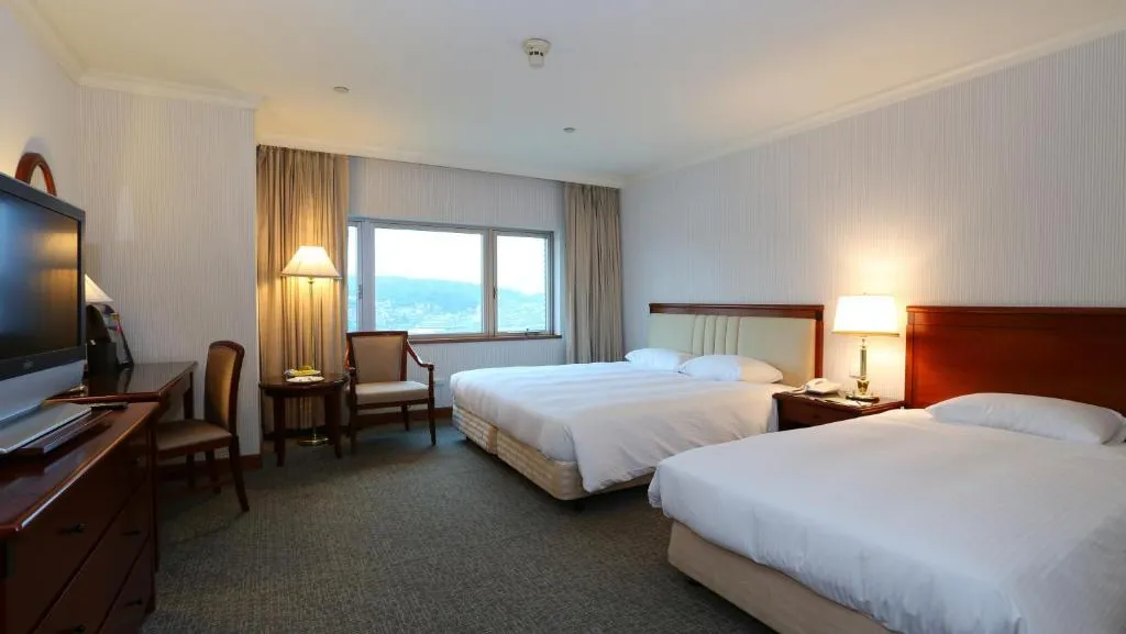
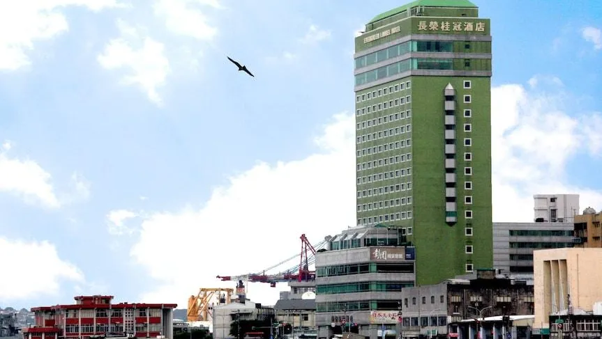
Evergreen Laurel Hotel (Keelung)
No.62-1, Zhongzheng Rd., Zhongzheng Dist., Keelung City 202, Taiwan (25°8'6.3"N 121°44'46.6"E)
To reserve your room with a discount for PORSEC 2025 attendees, kindly complete this reservation form and email it directly to the hotel
at elhklg@evergreen-hotels.com before February 28, 2025 (inclusive of breakfast).
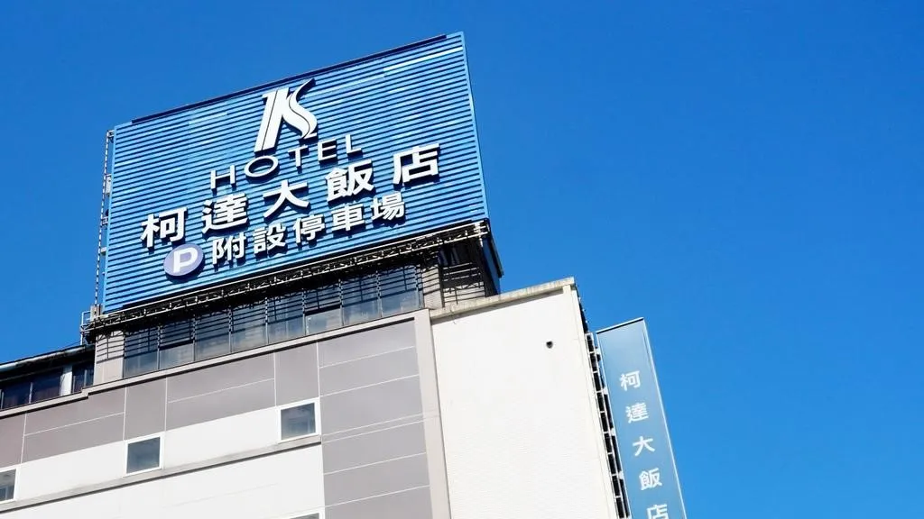
K Hotels Keelung
No. 7,Yi 1st.,Keelung, Taiwan (25°7'56.8"N, 121°44'42.5"E)
Reserve a room directly at K Hotel Keelung by sending an email to khotelkeelung@gmail.com with
the subject line “NTOU PORSEC2025” to enjoy a 35% discount(inclusive of breakfast).
Just Live Inn Keelung
No.156, Xin 1st Rd., Zhongzheng Dist.,Keelung City, Taiwan (25°7'48.4"N, 121°44'46.6"E)

Hotel Begin Keelung
No.51, Ln.446, beining Rd., Zhongzheng Dist.,Keelung City, Taiwan
Booking with PORSEC 2025 promo code
Please make sure booking room with the promo code "PORSEC2025" to get the discount.

Transportation
From Taipei Songshan Airport to Evergreen Laurel Hotel
Taipei Songshan Airport -> Evergreen Laurel Hotel
- Cost : about 900 TWD
- Travel time: about 40 ~ 50 min

Take bus 1802 to Keelung Train Station -> The hotel is about 11minutes walk from the train station, or 100TWD by taxi.
- Cost : about 55 TWD -155TWD
- Travel time: about 1hr

Take Subway brown line to Zhongxiao Fuxing -> Transfer to bus Line 1579 to Xinwu Road Intersection ->The hotel is about 2minutes walk from the Xinwu Road Intersection.
- Cost : about 120 TWD
- Travel time: about 1hr
From Taoyuan International Airport to Hotel in Keelung
Taiwan Taoyuan International Airport to Hotel in Keelung
- Cost :about 2100 TWD
- Travel time: about 55 min ~ 1hr 20min
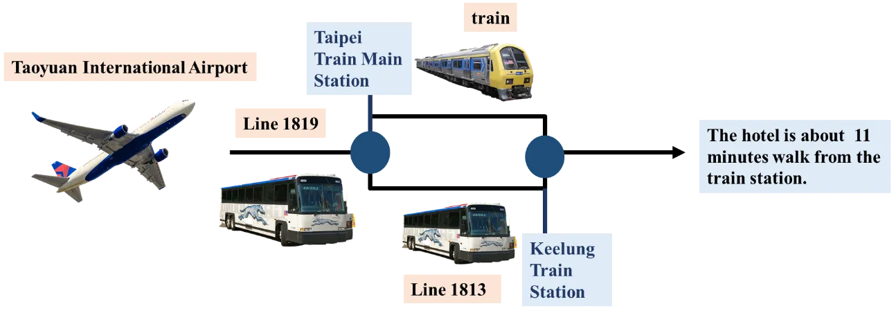
Take airport shuttle bus to Taipei Main Station -> Take train to Keelung Train Station or bus line 1813 -> The hotel is about a 11 minute walk from the train station, or 100 TWD by taxi.
- Cost : 166 ~ 280 TWD
- Travel time: about 1hr 40 min
Please visit the official website of Taoyuan International Airport for more information on airport shuttle bus.
VISA
For enquiries about Invitation letters for Visa, please contact:
porsec2025@gmail.com
FUNDING SUPPORT
ESSO-INCOIS proposes the scheme 'ESSO-INCOIS-PORSEC Travel Grant Fund' to provide financial support for the participation of young researchers and students from India in the 16th Pan Ocean Remote Sensing Conference (PORSEC-2025) in Keelung, Taiwan 22-26 April 2025.
The ESSO-INCOIS-PORSEC Travel Grant will cover the following fully/partially, subject to the availability of funding, and after necessary approvals:
- International travel support by economy fares at lowest rate available
- Accommodation (based on low-cost accommodation e.g. student hostels, dormitories or similar)
- Registration fees
Please complete this application form and send it not later than 21st March 2025 by email to director@incois.gov.in; pattabhi@incois.gov.in with ’INCOIS-PORSEC TRAVEL GRANT’ in the subject line.
PLEASE NOTE: Applications NOT RECEIVED by the given deadline will not be considered.
LOCAL ORGANIZING COMMITTEE
Here are our local committees
Prof. Ming-An Lee
Taiwan

Prof. Kuo-Wei Lan
Taiwan

Prof. Hsueh-Jung Lu
Taiwan

Prof. Chen-Te Tseng
Taiwan

Prof. Yi Chang
Taiwan

Prof. Chung-Ru Ho
Taiwan

Prof. Jay Chih-Chieh Young
Taiwan

Prof. Ting-Chun Kuo
Taiwan

Prof. Yuchun Lin
Taiwan

Prof. Hwa Chien
Taiwan

Dr. Yan-Lun Wu
16th PORSEC General Coordinator
Taiwan

Dr. Mubarak Mammel
16th PORSEC Tutorial Leader
Taiwan

Ms. Yee Chen
16th PORSEC Secretariat Head
Taiwan
SCIENTIFIC ORGANIZING COMMITTEE
Here are our scientific committees

Dr. Gad Levy
USA
President

Dr. Ming-An Lee
Taiwan
Acting President

Dr. Abderrahim Bentamy
French
Vice President/President Elect

Dr. Stefano Vignudelli
Italy
Vice President Elect

Dr. Nimit Kumar
India
Executive Secretary, Membership, Education and Outreach Chair

Dr. Cara Wilson
USA
Treasurer, Chair of Finance

Dr. Nurul Hazrina Idris
Malaysia
Chair local for PORSEC 2022
HOST

CO-HOST


